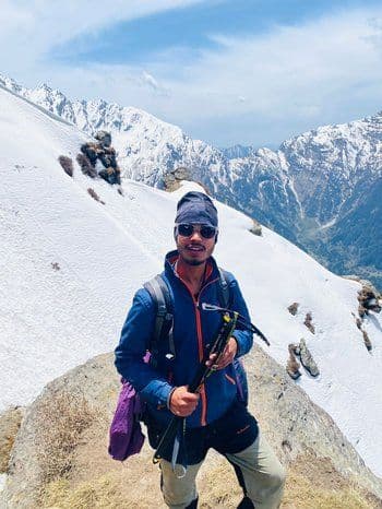
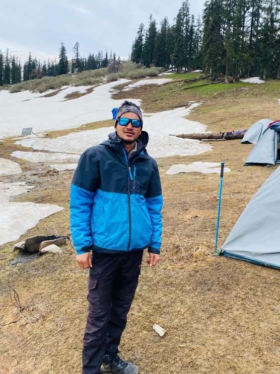
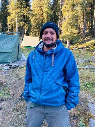
Gurja Himal (7,193 m / 23,599 ft) is a remote and impressive Himalayan peak located in western Nepal within the famous Dhaulagiri Range. The mountain lies south of the massive Dhaulagiri I and is considered one of the lesser-climbed peaks in the region, making it attractive for climbers seeking a true wilderness expedition. Because of its remote location and challenging terrain, Gurja Himal remains far less crowded than popular Himalayan climbing peaks.
The mountain is located at approximately 28°40′26″ North latitude and 83°16′37″ East longitude. From its summit, climbers can enjoy spectacular views of surrounding peaks including Dhaulagiri II, Dhaulagiri III, Dhaulagiri IV, Dhaulagiri V, Dhaulagiri VI, Putha Hiunchuli, and the beautiful Churen Himal group.
Historical Background
The history of Gurja Himal is closely connected with the early exploration of the Dhaulagiri region. During the 1950s and 1960s, several mountaineering teams explored the area and studied possible routes to the summit. Many climbers attempted to climb the mountain, but due to difficult terrain and limited knowledge of the routes, these early attempts were unsuccessful.
The first successful ascent of Gurja Himal was achieved on 1 November 1969 by a Japanese expedition team led by Yukio Yakushi. The team climbed the mountain via the West Ridge route. The successful climbing members included T. Saeki, Lhakpa Tenzing, A. Inouye, S. Kanayama, H. Sakai, and K. Shimoda. Their achievement opened the route for future climbers interested in exploring this remote Himalayan peak.
For a period between 1968 and 1979, the Government of Nepal restricted climbing permits for Gurja Himal, which limited expeditions in the area. After reopening, the mountain remained a rarely attempted expedition peak, attracting experienced mountaineers rather than commercial climbing groups.
Another important historical event occurred in 2018, when a sudden and powerful storm struck the Gurja Himal base camp area, resulting in a tragic avalanche that affected an international expedition team. This incident highlighted the unpredictable weather conditions of the high Himalayas and the importance of proper expedition planning and safety.
Significance for Mountaineers
Today, Gurja Himal is considered a challenging but rewarding 7000-meter expedition peak. It is especially appealing to climbers who want to experience a less crowded Himalayan climb compared to popular peaks like Ama Dablam, Baruntse, or Himlung Himal.
The mountain offers a combination of glacier travel, ice climbing, and high-altitude mountaineering, making it a perfect objective for climbers aiming to gain experience on high Himalayan expeditions.
Best Time to Visit Gurja Himal Expedition
Choosing the right season is very important for a successful and safe Gurja Himal Expedition, as weather conditions in the high Himalayas greatly affect climbing safety, visibility, and overall expedition experience. Climbing during the best seasons provides stable weather, clear mountain views, and better chances of reaching the summit.
Spring Season (March to May)
Temperatures: Spring is one of the most favorable seasons for climbing Gurja Himal. At lower trekking areas, daytime temperatures usually range between 12°C and 22°C. At Gurja Himal Base Camp (around 4,600 m), temperatures during the day normally remain between 5°C and 10°C, while nights can drop to -5°C to -10°C. At higher camps above 6,000 meters, temperatures may fall much lower, so proper high-altitude gear and warm clothing are essential.
Weather Conditions: Spring offers relatively stable weather, longer daylight hours, and clear visibility, which are ideal for climbing and acclimatization. The trekking trail to base camp passes through beautiful forests and traditional villages where rhododendron flowers bloom, creating colorful Himalayan landscapes. Climbers can enjoy spectacular views of nearby peaks such as Dhaulagiri II, Dhaulagiri III, Churen Himal, and Putha Hiunchuli. Because of the favorable climbing conditions, spring is one of the most popular seasons for the Gurja Himal expedition.
Autumn Season (September to November)
Temperatures: Autumn provides cool, crisp, and stable conditions for high-altitude climbing. At lower elevations along the trekking route, temperatures remain comfortable during the day. At Gurja Himal Base Camp, daytime temperatures generally range from 5°C to 12°C, while night temperatures often drop to -10°C or lower at higher camps.
Weather Conditions: Autumn is widely considered the best season for the Gurja Himal Expedition because the weather becomes stable after the monsoon. The skies are usually very clear, allowing climbers to enjoy breathtaking views of the Dhaulagiri Range and surrounding Himalayan peaks. The landscapes appear fresh and vibrant after the monsoon rains, with lush forests, rivers, and alpine meadows along the trekking route to base camp. Compared to spring, there are generally fewer climbers, making the experience more peaceful and remote.
Attaining the Height of the Gurja Himal Expedition
The Gurja Himal Expedition is regarded as a demanding yet rewarding high-altitude mountaineering journey in the remote western region of Nepal. Rising to an impressive height of 7,193 meters (23,599 ft) within the majestic Dhaulagiri Range, Gurja Himal offers climbers a true Himalayan expedition experience away from the busy commercial climbing routes. Unlike popular trekking peaks, this mountain requires previous high-altitude climbing experience, technical mountaineering knowledge, and strong physical endurance.
Climbers attempting Gurja Himal must be prepared for long trekking days, glacier travel, steep snow and ice climbing, and challenging weather conditions. The expedition not only tests physical strength but also demands patience, mental resilience, and the ability to adapt to the unpredictable environment of the high Himalayas.
Altitude Challenges - One of the most significant challenges during the Gurja Himal expedition is the rapid gain in altitude. The expedition generally begins with a drive from Kathmandu to Pokhara and continues toward the trekking starting point near Darbang village. From here, climbers trek through remote settlements and alpine landscapes before reaching Gurja Himal South Base Camp, which is located at approximately 4,600 meters (15,091 ft).
From the base camp, climbers continue their ascent by establishing a series of higher camps to ensure proper acclimatization and safety. Typically, the expedition sets up Camp I at around 5,300 meters, Camp II at 5,900 meters, and Camp III at approximately 6,500 meters. Each camp plays a vital role in helping climbers adjust to the reduced oxygen levels found at high elevations.
As altitude increases, the oxygen level in the atmosphere decreases significantly, which may cause symptoms such as fatigue, headache, dizziness, or shortness of breath. These symptoms are associated with altitude-related illnesses such as Acute Mountain Sickness (AMS). To minimize risks, the expedition itinerary includes gradual ascent, rest days, and acclimatization rotations between camps, allowing climbers’ bodies to adjust naturally before attempting the summit.
Terrain and Weather Conditions - The route to Gurja Himal presents a wide range of terrains and landscapes, making the expedition both challenging and visually spectacular. The initial trekking route passes through traditional mountain villages, terraced farmland, dense forests, and alpine meadows. As climbers move higher toward base camp, the scenery gradually changes into glacial valleys, rocky moraines, and snow-covered landscapes.
Beyond base camp, the climb becomes more technical and demanding. Climbers must navigate glaciers, crevasses, steep ice slopes, and narrow ridges. Fixed ropes are often used in steeper sections to ensure safety during both ascent and descent. Experience in ice climbing, rope techniques, and using mountaineering equipment such as crampons and ice axes is essential.
Weather conditions in the Dhaulagiri Range can change rapidly. Climbers may encounter strong winds, snowfall, sudden temperature drops, and occasional storms, especially at higher camps above 6,000 meters. Temperatures can fall well below -20°C at night, making proper high-altitude gear and careful planning extremely important. The success of the summit attempt often depends on identifying a stable weather window for the final push to the top.
Physical Endurance Requirements - The Gurja Himal expedition requires excellent physical conditioning and stamina. Climbers must be able to trek for 6 to 8 hours per day during the approach to base camp while carrying personal gear. Once the climbing phase begins, the effort becomes even more demanding as climbers ascend steep slopes and travel across glaciers at extreme altitudes.
Preparation for this expedition should ideally begin several months before departure. Training programs should include: Cardiovascular exercises such as running, cycling, or swimming to improve endurance., Strength training focused on legs, core, and upper body., Hiking with a loaded backpack to simulate real trekking conditions., Previous climbing experience, preferably on peaks above 6,000 meters, to develop familiarity with high-altitude environments.
Mental strength is equally important, as climbers must remain patient during acclimatization periods and adapt to the challenges of living in remote mountain conditions.
Remote Expedition Environment
The Gurja Himal region is one of the least explored and most remote mountaineering destinations in Nepal. Unlike popular trekking routes such as those around Annapurna or Everest, infrastructure in this area is limited.
During the trekking approach to base camp, climbers stay in basic tea houses or simple local lodges in villages along the trail. These accommodations offer simple twin-sharing rooms and traditional meals prepared by local hosts.
Once the expedition reaches Gurja Himal Base Camp, all accommodation shifts to fully equipped expedition tents organized by the climbing support team. A dedicated kitchen crew prepares meals rich in carbohydrates and proteins to maintain energy levels during climbing days.
Although the facilities are simple, the expedition provides an authentic Himalayan wilderness experience, surrounded by breathtaking mountain scenery. From base camp and higher camps, climbers can enjoy stunning views of nearby peaks such as Dhaulagiri II, Dhaulagiri III, Churen Himal, and Putha Hiunchuli.
The Reward of Reaching the Summit - Despite its challenges, summiting Gurja Himal is an extraordinary achievement for any mountaineer. Standing on the summit at over 7,000 meters, climbers are rewarded with breathtaking panoramic views of the vast Himalayan landscape and the towering peaks of the Dhaulagiri region.
The combination of remote wilderness, challenging climbing routes, and spectacular mountain scenery makes the Gurja Himal expedition a truly unforgettable adventure for experienced climbers seeking a unique Himalayan challenge.
Which Peaks Are Visible During the Gurja Himal Expedition Trail
The trekking route and climbing journey to Gurja Himal offers spectacular views of some of the most impressive mountains in western Nepal. Located in the remote region of the Dhaulagiri Range, the expedition route takes climbers through beautiful valleys, traditional villages, and alpine landscapes before reaching the high-altitude base camp. Throughout the journey, trekkers and climbers are rewarded with breathtaking views of towering snow-covered Himalayan peaks.
Mountain Views Along the Trekking Route - During the initial trekking days from villages like Darbang, Takum, and Gurja Village, the trail passes through lush forests, terraced farmlands, and scenic valleys. As trekkers gain elevation, the surrounding landscape gradually opens up, revealing the impressive peaks of the Dhaulagiri region.
One of the most prominent mountains visible along the route is Dhaulagiri II (7,751 m), which rises dramatically above the surrounding ridges. Trekkers can also spot Dhaulagiri III (7,715 m) and Dhaulagiri IV (7,661 m), part of the massive Dhaulagiri massif that dominates the skyline of western Nepal.
Views Near Gurja Himal Base Camp - As climbers approach Gurja Himal Base Camp, located at approximately 4,600 meters, the landscape changes into a rugged alpine environment with glaciers, rocky moraines, and wide open mountain views. From this area, several impressive Himalayan peaks become clearly visible.
One of the most striking mountains in the region is Churen Himal, which has three main summits—Main, East, and West—and stands prominently above the surrounding valleys. The peak’s steep ridges and snowy slopes make it one of the most visually impressive mountains near the Gurja Himal region.
Another significant peak visible from the base camp area is Putha Hiunchuli (Dhaulagiri VII), a large and beautiful mountain known for its wide glaciers and relatively accessible climbing routes compared to other peaks in the Dhaulagiri range.
Panoramic Views from Higher Camps and the Summit - As climbers move higher toward Camp I, Camp II, and Camp III, the views become even more dramatic. The vast Himalayan landscape unfolds in every direction, with massive snow-covered peaks and deep glacial valleys stretching across the horizon.
From the upper sections of the Gurja Himal climb, climbers can enjoy spectacular views of Dhaulagiri V, Dhaulagiri VI, and surrounding unnamed Himalayan peaks. The sense of remoteness and untouched wilderness becomes even more evident at these elevations.
Reaching the summit of Gurja Himal offers an extraordinary 360-degree panoramic view of the entire Dhaulagiri region. Standing at over 7,000 meters, climbers are surrounded by towering Himalayan giants, glaciers, and endless mountain ridges, creating one of the most rewarding visual experiences in Nepal’s high mountains.
A Unique Himalayan Mountain Experience - Unlike more popular trekking regions, the Gurja Himal trail remains less crowded and relatively unexplored, allowing climbers to enjoy uninterrupted views of the Himalayan landscape. The combination of remote trekking routes, dramatic mountain scenery, and close views of the Dhaulagiri peaks makes the Gurja Himal expedition a truly unforgettable journey for experienced adventurers.
How to Reach the Gurja Himal Expedition
The Gurja Himal Expedition begins in Kathmandu, the capital and main international gateway of Nepal. All expedition preparations, permit arrangements, and team briefings are typically completed in Kathmandu before traveling toward the remote Dhaulagiri region where Gurja Himal is located. From Kathmandu, climbers travel to Pokhara and then continue by road to the trekking starting point near Darbang village.
Traveling to Kathmandu
By Air
International Flights: Kathmandu is served by Tribhuvan International Airport (IATA: KTM), the main international airport of Nepal and the primary entry point for travelers coming from abroad. Several major airlines operate direct or connecting flights to Kathmandu from important international hubs, including Nepal Airlines, Qatar Airways, and Turkish Airlines. This makes Kathmandu easily accessible for climbers planning the Gurja Himal expedition.
Domestic Flights: For travelers already inside Nepal, frequent domestic flights connect Kathmandu with major cities such as Pokhara, Biratnagar, Bhairahawa, and Nepalgunj. Most Gurja Himal expeditions include a short domestic flight or road journey from Kathmandu to Pokhara before continuing toward the Dhaulagiri region.
Travel from Kathmandu to the Gurja Himal Region
After completing expedition preparations in Kathmandu, the journey continues to Pokhara, one of Nepal’s most beautiful cities and a common starting point for many Himalayan expeditions. From Pokhara, the team travels by private jeep or local vehicle to Darbang, a remote village that serves as the starting point of the trekking route.
The trekking trail from Darbang gradually ascends through remote mountain settlements such as Takum, Lumsung, and Gurja Village before reaching Gurja Himal Base Camp, located at around 4,600 meters. The trek to base camp usually takes about 6 to 7 days, offering beautiful scenery and views of the surrounding peaks in the Dhaulagiri Range.
Overland Travel to Nepal
From India: Nepal shares an open border with India, making overland travel convenient for many international visitors. Popular border crossing points include Sunauli–Bhairahawa and Raxaul–Birgunj. From these border towns, travelers can take buses, tourist coaches, or private vehicles to reach Kathmandu, where the Gurja Himal expedition preparations begin.
The journey to Gurja Himal itself is part of the adventure. Traveling from bustling Kathmandu to the remote valleys of the Dhaulagiri region allows climbers to experience Nepal’s diverse landscapes, cultures, and mountain scenery before beginning the challenging ascent of this magnificent Himalayan peak.
Gurja Himal Expedition Difficulty Level
The Gurja Himal Expedition is considered a challenging high-altitude mountaineering expedition suitable for experienced climbers. Rising to 7,193 meters (23,599 ft) in the remote western part of Nepal within the Dhaulagiri Range, Gurja Himal demands strong physical fitness, technical climbing skills, and the ability to adapt to extreme mountain environments. Unlike trekking routes, this expedition includes glacier crossings, steep snow and ice climbing, high-altitude camps, and fixed rope sections, making it significantly more demanding than regular Himalayan treks.
Geographical Location and Terrain
Geographically, Gurja Himal lies in the Myagdi District of western Nepal, south of the massive Dhaulagiri I. The mountain forms part of the Dhaulagiri Himalayan massif, which is known for its rugged terrain, deep valleys, and massive glaciers.
The expedition begins in Kathmandu, from where climbers travel to Pokhara and then continue by road to Darbang, the starting point of the trek. From Darbang, the route passes through remote mountain settlements such as Takum, Lumsung, and Gurja Village before reaching the Gurja Himal South Base Camp at around 4,600 meters.
The geography of the region includes steep valleys, dense forests, alpine meadows, rocky moraines, and glacial landscapes. As climbers ascend higher, the terrain becomes dominated by snowfields, glaciers, crevasses, and exposed ridgelines, which significantly increase the difficulty of the climb.
Proper Gear and Technical Equipment - Because of the mountain’s harsh geographical environment, climbers must carry specialized mountaineering equipment. Essential gear includes crampons, ice axes, helmets, harnesses, climbing ropes, insulated boots, and high-altitude clothing.
Temperatures in the Gurja Himal region can vary greatly depending on elevation. While the lower trekking areas may experience moderate temperatures, the higher camps above 6,000 meters often experience temperatures below -20°C, accompanied by strong winds and snowstorms. Proper gear ensures safety and protection against these extreme conditions.
Hydration and Nutrition - At high altitudes, the human body loses fluids quickly due to dry mountain air and intense physical exertion. Climbers must drink at least 3–4 liters of water daily to maintain hydration and reduce the risk of altitude sickness.
Meals during the expedition typically consist of high-energy foods such as rice, pasta, soups, vegetables, and energy snacks. These meals help climbers maintain stamina during long trekking days and demanding climbing sections.
Weather and Environmental Conditions - The weather in the Dhaulagiri Range is highly unpredictable. The region is known for strong winds, heavy snowfall, sudden storms, and rapid temperature changes. Because of its geographical position near high Himalayan peaks, the Gurja Himal area often experiences extreme weather conditions.
Climbers usually attempt the expedition during the spring (March–May) or autumn (September–November) seasons, when weather conditions are relatively stable and visibility is clearer. Even during these seasons, teams must remain flexible and wait for a safe weather window before making the summit attempt.
Emergency Preparedness in a Remote Region - The Gurja Himal region is geographically remote and sparsely populated, with very limited infrastructure. Communication networks and medical facilities are minimal, especially beyond the trekking villages.
For this reason, expedition teams carry satellite phones, first-aid kits, oxygen cylinders, and emergency rescue equipment. Experienced Sherpa guides play a crucial role in ensuring climbers’ safety, navigating difficult terrain, and managing emergencies.
Physical Fitness and Mental Endurance - Climbing Gurja Himal requires excellent physical conditioning and endurance. The expedition involves long trekking days to reach base camp and demanding climbs on steep snow and ice slopes above 5,000 meters.
Climbers are recommended to prepare through cardiovascular training, strength exercises, endurance hiking, and previous high-altitude climbing experience on peaks above 6,000 meters. Mental resilience is equally important, as climbers must cope with isolation, fatigue, and harsh weather conditions in the remote Himalayan environment.
Acclimatization and Climbing Strategy - Due to the significant altitude gain, proper acclimatization is critical for a safe expedition. The climbing team gradually ascends through a series of high camps:
Camp I: 5,300 m
Camp II: 5,900 m
Camp III: 6,500 m
These camps allow climbers to adjust to lower oxygen levels before attempting the final summit push. A slow and steady climbing pace, along with rest days, helps reduce the risk of altitude-related illnesses.
A True Himalayan Challenge - Overall, the Gurja Himal Expedition is a demanding mountaineering adventure that combines technical climbing, high-altitude endurance, and remote Himalayan exploration. Its dramatic geography, rugged landscapes, and stunning mountain views make it one of the most unique climbing experiences in the Dhaulagiri region of Nepal.
For climbers seeking a less crowded yet highly challenging 7000-meter peak, Gurja Himal offers an unforgettable Himalayan expedition.
Safety Factors During the Gurja Himal Expedition
Safety is a critical aspect of the Gurja Himal Expedition, as the climb involves extreme altitude, technical terrain, unpredictable weather, and a remote mountain environment. Rising to 7,193 meters (23,599 ft) in the rugged Dhaulagiri Range of Nepal, Gurja Himal demands careful planning, proper acclimatization, and strong teamwork to ensure a safe and successful climb.
Proper Acclimatization - One of the most important safety factors in the Gurja Himal expedition is proper acclimatization. The climb involves a significant altitude gain, beginning from lower villages near Darbang and gradually ascending to Gurja Himal Base Camp at around 4,600 meters.
From base camp, climbers move through a series of high camps to adjust to the decreasing oxygen levels:
Camp I: 5,300 m
Camp II: 5,900 m
Camp III: 6,500 m
Gradual ascent and scheduled rest days allow the body to adapt naturally. Climbers should remain alert to early symptoms of altitude sickness such as headaches, dizziness, nausea, fatigue, or shortness of breath, and immediately inform guides if these symptoms occur.
Experienced Sherpa Guides and Support Team - Climbing Gurja Himal with experienced Sherpa guides significantly improves safety. These professional mountaineers possess extensive knowledge of the mountain’s terrain, weather patterns, and climbing routes.
Sherpa guides play an important role in: (Fixing ropes along steep or technical sections, Establishing high camps, Monitoring weather conditions, Assisting climbers during difficult sections of the ascent)
Their experience in the Dhaulagiri Range is invaluable for managing risks and ensuring the safety of the expedition team.
Physical Preparation and Climbing Experience - Strong physical fitness and prior mountaineering experience are essential for the Gurja Himal expedition. Climbers should ideally have experience climbing peaks above 6,000 meters before attempting this mountain.
Training before the expedition should include: Cardiovascular exercises such as running, cycling, or swimming, Strength training for legs and core muscles, Endurance hikes with a loaded backpack, Basic mountaineering skills including rope handling and ice climbing)
Proper preparation reduces the risk of injuries and exhaustion during the expedition.
Weather Awareness and Route Safety - Weather in the Dhaulagiri Range can change rapidly, with strong winds, heavy snowfall, and sudden storms occurring even during favorable seasons.
Climbers must remain aware of daily weather updates and follow the guidance of expedition leaders when planning summit attempts. If conditions become unsafe, teams may postpone or cancel summit pushes to avoid unnecessary risks.
Climbers should always follow fixed ropes, marked routes, and guide instructions, especially when crossing glaciers, steep ice slopes, and exposed ridges.
Proper Mountaineering Gear and Equipment - Using appropriate high-altitude mountaineering gear is crucial for safety on Gurja Himal. Essential equipment includes: Insulated high-altitude boots, Crampons and ice axes, Climbing harness and helmets, Down jackets and layered clothing, Gloves, goggles, and headlamps)
These items help climbers remain protected from extreme cold, strong winds, and hazardous terrain found at higher elevations.
Hydration and Nutrition - Maintaining proper hydration and nutrition is essential for high-altitude climbing. The body requires extra energy and fluids to perform efficiently in thin air.
Climbers should drink 3–4 liters of water per day and consume energy-rich foods such as rice, pasta, soups, vegetables, and high-calorie snacks. Proper nutrition helps maintain stamina, improves recovery, and supports acclimatization.
Emergency Preparedness and Communication - Due to the remote location of Gurja Himal, emergency preparedness is extremely important. Communication networks are limited in the region, so expedition teams usually carry satellite phones, radios, and emergency rescue equipment.
Climbing teams also carry first-aid kits, oxygen cylinders, and medical supplies to handle altitude-related health issues. In case of serious emergencies, helicopter evacuation may be arranged from lower camps if weather conditions allow.
Travel and Expedition Insurance - Comprehensive travel and expedition insurance is strongly recommended for climbers attempting Gurja Himal. The insurance policy should cover: High-altitude mountaineering above 7,000 meters, Medical emergencies, Helicopter rescue and evacuation, Trip cancellations due to weather or other unforeseen circumstances)
Having proper insurance ensures financial protection and peace of mind during the expedition.
A Safe and Responsible Himalayan Expedition
Climbing Gurja Himal is a serious mountaineering challenge that requires careful preparation, experienced leadership, and respect for the mountain environment. By focusing on acclimatization, physical preparation, proper gear, and safety awareness, climbers can significantly improve their chances of completing the expedition successfully while minimizing risks in the remote Himalayan wilderness.
How to Prepare for Gurja Peak Expedition
Prepare yourself for an unforgettable Himalayan adventure with TrekYaari as you get ready for the Gurja Himal Expedition. This remote and challenging journey offers a perfect combination of high-altitude mountaineering, cultural encounters, and spectacular Himalayan scenery. With proper preparation and guidance, the expedition becomes a safe, rewarding, and life-changing experience for climbers seeking to explore one of the less-visited regions of the Himalayas.
Understanding the Expedition Route – The expedition generally begins in Pokhara, one of Nepal’s main trekking gateways. From Pokhara, the journey continues toward the remote villages of the Myagdi region, eventually reaching Gurja village, which serves as the primary access point to the mountain. The trail passes through traditional settlements, terraced farmlands, dense forests, and rugged mountain terrain before reaching the base camp of Gurja Peak. As climbers move higher, the landscape transforms into glacial valleys and snow-covered slopes beneath the towering peaks of the Dhaulagiri Himal.
Altitude Acclimatization – Since Gurja Peak rises above 7,000 meters, proper acclimatization is extremely important during the expedition. Climbers ascend gradually from lower villages to base camp and higher camps, allowing the body to adjust naturally to the decreasing oxygen levels. Adequate rest days, hydration, and maintaining a steady climbing pace are essential to reduce the risk of altitude sickness and ensure a successful summit attempt.
Physical and Mental Preparation – The Gurja Peak expedition requires a strong level of physical fitness and prior trekking or mountaineering experience. Training should ideally begin several weeks before the expedition and focus on cardiovascular endurance, strength training, and stamina. Mental preparation is equally important, as climbers must be ready to face long climbing days, changing weather conditions, and the challenges of high-altitude mountaineering.
Cultural Experience and Local Interaction – The region surrounding Gurja Peak is home to traditional Magar communities, who have lived in these mountain valleys for generations. During the expedition, climbers have the opportunity to interact with local villagers, observe traditional lifestyles, and experience authentic Himalayan culture. These cultural encounters add a meaningful dimension to the journey and create a deeper connection with the region.
Panoramic Himalayan Views – The Gurja region offers breathtaking views of several majestic Himalayan peaks. Throughout the approach trek and climbing stages, climbers can witness stunning panoramas of surrounding mountains, including Dhaulagiri, Churen Himal, and Putha Hiunchuli. The dramatic contrast between deep valleys, massive glaciers, and snow-covered peaks creates a spectacular Himalayan environment.
Reaching the Summit of Gurja Peak – Standing on the summit of Gurja Peak is a truly remarkable achievement. At over 7,000 meters above sea level, the summit offers extraordinary views across the vast Himalayan ranges. Surrounded by towering peaks and expansive glacial landscapes, climbers experience a profound sense of accomplishment and connection with the grandeur of the Himalayas.
Best Seasons for the Expedition – The best seasons for the Gurja Peak expedition are spring (April to May) and autumn (September to October). During these months, weather conditions are generally more stable, with clearer skies and safer climbing conditions compared to the monsoon or harsh winter seasons.
Permits and Expedition Logistics – Climbers undertaking the Gurja Peak expedition require several permits issued by the Nepal Mountaineering Association and the government of Nepal. Proper logistical planning, including guides, porters, climbing equipment, and base camp support, is essential to ensure safety and a smooth expedition experience.
Essential Gear and Equipment – Mountaineering gear plays a crucial role in the success of a Gurja Peak expedition. Climbers need high-quality climbing boots, insulated clothing layers, down jackets, sleeping bags designed for extreme temperatures, harnesses, ropes, crampons, ice axes, and personal medical kits. Carrying the right equipment ensures safety and preparedness for harsh high-altitude conditions.
With proper preparation, determination, and expert guidance, the Gurja Peak expedition becomes far more than just a climb—it transforms into a powerful journey of exploration, resilience, and personal achievement. The remote valleys, traditional mountain villages, and dramatic Himalayan landscapes create an experience that few adventurers ever encounter. At TrekYaari, we are committed to supporting you throughout the entire expedition—from planning and logistics to safety and summit success—ensuring that your journey to Gurja Peak becomes a truly unforgettable Himalayan adventure


